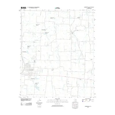
2010 Map of Farmersville
USGS Topo · Published 2010About this map
Farmersville and the community of Merit anchor this northern Texas landscape, which is defined by a sophisticated network of water management sites. Numerous Soil Conservation Service dams, including Soil Conservation Service Site 73 Dam and Soil Conservation Service Site 82 Dam, regulate the many creeks flowing through the area, such as Hickory Creek and Brushy Creek. These structures create significant local water bodies like North Lake and South Lake, illustrating the intersection of regional agriculture and modern environmental engineering. Genealogy researchers will find several well-documented burial sites throughout the quadrangle, including Liberty Cemetery, Twin Cemetery, and Hopewell Cemetery. The presence of small aviation facilities like Short Stop Airport and the Flying m Airport suggests a rural area well-integrated with local transportation and private commerce.
Find a feature on this map
81 named features on this map. Tap any name to fly to it.
Don’t see what you’re looking for? This feature index may not catch every label — zoom into the map to look around manually.
Map Details
Editions of this 2010 Farmersville Map
This is the sole edition of this map. No revisions or reprints were ever made.
Other maps of this area

1924 · Farmersville 3-c
USGS Topo · 1:48,000

1930 · Farmersville
USGS Topo · 1:62,500

1954 · Sherman
USGS Topo · 1:250,000

1958 · Sherman
USGS Topo · 1:250,000

1960 · Blue Ridge
USGS Topo · 1:24,000

1960 · Pike
USGS Topo · 1:24,000

1960 · Culleoka
USGS Topo · 1:24,000

1962 · Greenville NW
USGS Topo · 1:24,000

1962 · Greenville SW
USGS Topo · 1:24,000

1962 · Farmersville
USGS Topo · 1:24,000