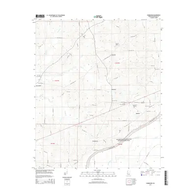
2015 Map of Farmhaven
USGS Topo · Published 2015About this map
Natchez Trace Parkway and National Scenic Trail cuts a diagonal path through this part of Madison County, following a historic travel corridor through a landscape defined by numerous creek branches. The settlements of Farmhaven, Raytown, and Millville serve as local hubs, surrounded by a dense network of country roads named for local families and landmarks, such as Virgin Mary Rd, Pat Luckett Rd, and Bill Day Rd.
Find a feature on this map
62 named features on this map. Tap any name to fly to it.
Don’t see what you’re looking for? This feature index may not catch every label — zoom into the map to look around manually.
Map Details
Editions of this 2015 Farmhaven Map
This is the sole edition of this map. No revisions or reprints were ever made.
Other maps of this area

1953 · Meridian
USGS Topo · 1:250,000

1957 · Meridian
USGS Topo · 1:250,000

1960 · Sharon
USGS Topo · 1:62,500

1961 · Carthage
USGS Topo · 1:62,500

1962 · Thomastown
USGS Topo · 1:62,500

1964 · Camden
USGS Topo · 1:24,000

1965 · Meridian
USGS Topo · 1:250,000
1966 · Goodman
USGS Topo · 1:62,500

1984 · Carthage
USGS Topo · 1:100,000
1988 · Sharon
USGS Topo · 1:24,000