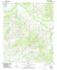
1988 Map of Sharon
USGS Topo · Published 1989About this map
The settlement of Sharon sits at the heart of this Madison County landscape, a rural community defined by its network of country churches and watercourses. Mapping updated in the late 1980s reveals a pattern of scattered homesteads and small family-named landmarks like Hassley Herron Lake and Tithel Lake. Religious life is central to the area's geography, with congregations established at Sims Chapel, St Paul Ch, and Mt Zion Ch among many others.
Find a feature on this map
27 named features on this map. Tap any name to fly to it.
Don’t see what you’re looking for? This feature index may not catch every label — zoom into the map to look around manually.
Map Details
Editions of this 1988 Sharon Map
This is the sole edition of this map. No revisions or reprints were ever made.
Other maps of this area

1953 · Meridian
USGS Topo · 1:250,000

1955 · Jackson
USGS Topo · 1:250,000

1957 · Meridian
USGS Topo · 1:250,000

1960 · Sharon
USGS Topo · 1:62,500

1961 · Jackson
USGS Topo · 1:250,000

1961 · Canton
USGS Topo · 1:62,500

1962 · Jackson
USGS Topo · 1:250,000

1964 · Camden
USGS Topo · 1:24,000

1964 · Vaughan
USGS Topo · 1:24,000

1965 · Meridian
USGS Topo · 1:250,000