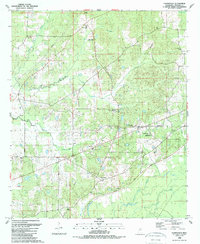
1988 Map of Farmhaven
USGS Topo · Published 1989About this map
Natchez Trace Parkway cuts across this landscape in Madison County, following the path of the historic wilderness road. The area's social fabric is densely represented by its rural institutions, with small settlements like Raytown and Farmhaven serving as anchor points. For those tracing local families, the map is remarkably detailed with genealogy-rich landmarks, including Eugene Garrett Mem Garden Cem, St Elizabeth Cem, and the Sulphur Springs Cem. Education and faith are closely linked here, evidenced by sites like the Sacred Heart Sch and Luther-Branson Sch. The terrain is defined by the drainage of Kentuctah Creek and Doaks Creek, while the Old Indian Treaty Boundary persists as a significant cadastral line, marking the historical layers of Mississippi's land division. Numerous country churches, such as Rising Chapel and Liberty Ch, are scattered across the quadrangle.
Find a feature on this map
40 named features on this map. Tap any name to fly to it.
Don’t see what you’re looking for? This feature index may not catch every label — zoom into the map to look around manually.
Map Details
Editions of this 1988 Farmhaven Map
This is the sole edition of this map. No revisions or reprints were ever made.
Other maps of this area

1953 · Meridian
USGS Topo · 1:250,000

1957 · Meridian
USGS Topo · 1:250,000

1960 · Sharon
USGS Topo · 1:62,500

1961 · Carthage
USGS Topo · 1:62,500

1962 · Thomastown
USGS Topo · 1:62,500

1964 · Camden
USGS Topo · 1:24,000

1965 · Meridian
USGS Topo · 1:250,000
1966 · Goodman
USGS Topo · 1:62,500

1984 · Carthage
USGS Topo · 1:100,000
1988 · Sharon
USGS Topo · 1:24,000