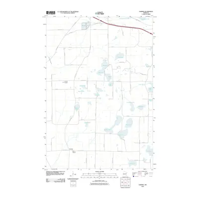
2010 Map of Farming
USGS Topo · Published 2010About this map
Farming serves as the primary settlement hub in this part of Stearns County, where the agricultural landscape is heavily defined by its glacial hydrology. The terrain is densely pocketed with water bodies ranging from Big Rice Lake and Little Rice Lake to smaller basins like Eggert Lake and Kranz Lake. The drainage network, including the Spunk Branch, winds through a grid of rural roads that connect long-established community centers. For those tracing local history, the map provides precise locations for Saint Catherine's and the Immanuel Lutheran Church, along with their respective burial grounds, Saint Catherine's Cemetery and the Immanuel Lutheran Church Cemetery. In the northern section, the Lake Wobegon Trl utilizes a former rail corridor, cutting across the landscape near Schwinghamer Lake and Englemeier Lake, signaling a transition from industrial transport to modern recreational use.
Find a feature on this map
66 named features on this map. Tap any name to fly to it.
Don’t see what you’re looking for? This feature index may not catch every label — zoom into the map to look around manually.
Map Details
Editions of this 2010 Farming Map
This is the sole edition of this map. No revisions or reprints were ever made.
Other maps of this area

1953 · Saint Cloud
USGS Topo · 1:250,000

1957 · Saint Cloud
USGS Topo · 1:250,000

1958 · Saint Cloud
USGS Topo · 1:250,000

1965 · Albany
USGS Topo · 1:24,000

1965 · Farming
USGS Topo · 1:24,000

1965 · Holdingford
USGS Topo · 1:24,000

1965 · Freeport
USGS Topo · 1:24,000

1965 · St Martin
USGS Topo · 1:24,000

1965 · Avon
USGS Topo · 1:24,000

1967 · Cold Spring
USGS Topo · 1:24,000