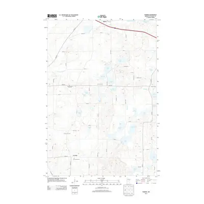
2013 Map of Farming
USGS Topo · Published 2013About this map
Farming and Albany anchor this Stearns County landscape, a region defined by its glacial kettle lakes and organized agricultural plots. The map reveals a community deeply tied to its local institutions, with Immanuel Lutheran Church and its accompanying Immanuel Lutheran Church Cem serving the northern reaches, while Saint Catherine's and Saint Catherine's Cem provide a focal point for the settlement of Farming further south. The drainage patterns of County Ditch Number Six and the numerous small water bodies like Fifth Lake, Big Rice Lake, and Schwinghamer Lake illustrate the complex hydrography of the Minnesota lake country. Local industry and land use are clearly visible through specialized agricultural sites such as the Schlangen Dairy Farm and the Windmill Orchard, reflecting the enduring dairy and orchard traditions of the central Minnesota plains.
Find a feature on this map
66 named features on this map. Tap any name to fly to it.
Don’t see what you’re looking for? This feature index may not catch every label — zoom into the map to look around manually.
Map Details
Editions of this 2013 Farming Map
This is the sole edition of this map. No revisions or reprints were ever made.
Other maps of this area

1953 · Saint Cloud
USGS Topo · 1:250,000

1957 · Saint Cloud
USGS Topo · 1:250,000

1958 · Saint Cloud
USGS Topo · 1:250,000

1965 · Albany
USGS Topo · 1:24,000

1965 · Farming
USGS Topo · 1:24,000

1965 · Holdingford
USGS Topo · 1:24,000

1965 · Freeport
USGS Topo · 1:24,000

1965 · St Martin
USGS Topo · 1:24,000

1965 · Avon
USGS Topo · 1:24,000

1967 · Cold Spring
USGS Topo · 1:24,000