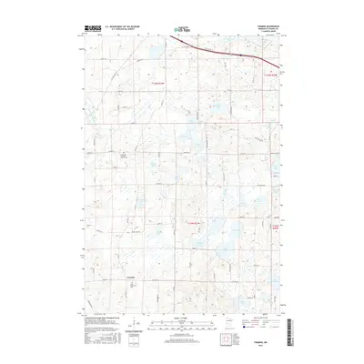
2016 Map of Farming
USGS Topo · Published 2016About this map
The settlement of Farming anchors this central Minnesota landscape, situated within a dense network of glacial water bodies and drainage systems. The map detail highlights the spiritual and ancestral geography of the area, featuring Saint Catherine's Cem near the town center and the Immanuel Lutheran Church Cem to the northwest. These sites, along with family-named landmarks like Schwinghamer Lake and Englemeier Lake, provide significant points of interest for genealogists tracing local heritage.
Find a feature on this map
78 named features on this map. Tap any name to fly to it.
Don’t see what you’re looking for? This feature index may not catch every label — zoom into the map to look around manually.
Map Details
Editions of this 2016 Farming Map
This is the sole edition of this map. No revisions or reprints were ever made.
Other maps of this area

1953 · Saint Cloud
USGS Topo · 1:250,000

1957 · Saint Cloud
USGS Topo · 1:250,000

1958 · Saint Cloud
USGS Topo · 1:250,000

1965 · Albany
USGS Topo · 1:24,000

1965 · Farming
USGS Topo · 1:24,000

1965 · Holdingford
USGS Topo · 1:24,000

1965 · Freeport
USGS Topo · 1:24,000

1965 · St Martin
USGS Topo · 1:24,000

1965 · Avon
USGS Topo · 1:24,000

1967 · Cold Spring
USGS Topo · 1:24,000