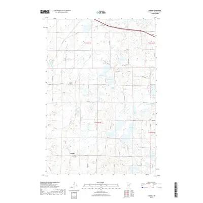
2019 Map of Farming
USGS Topo · Published 2019About this map
The settlement of Farming and the southern edge of Albany anchor this Stearns County landscape, where the glacial geography of central Minnesota is defined by a dense network of lakes and marshes. Local history and genealogy are centered around congregational hubs like Immanuel Lutheran Church with its adjacent Immanuel Lutheran Cem, and the southern parish of Saint Catherine's and Saint Catherine's Cem. The drainage of the land is shaped by the Spunk Br and the complex of water bodies including Big Rice Lake, Mauritz Lake, and Schwinghamer Lake. In the northeast, the town of Avon is situated along the major transit corridor of Co St Aid Hwy 54, while the surrounding sections are organized by a grid of rural roads and drainage infrastructure like County Ditch Number 21.
Find a feature on this map
59 named features on this map. Tap any name to fly to it.
Don’t see what you’re looking for? This feature index may not catch every label — zoom into the map to look around manually.
Map Details
Editions of this 2019 Farming Map
This is the sole edition of this map. No revisions or reprints were ever made.
Other maps of this area

1953 · Saint Cloud
USGS Topo · 1:250,000

1957 · Saint Cloud
USGS Topo · 1:250,000

1958 · Saint Cloud
USGS Topo · 1:250,000

1965 · Albany
USGS Topo · 1:24,000

1965 · Farming
USGS Topo · 1:24,000

1965 · Holdingford
USGS Topo · 1:24,000

1965 · Freeport
USGS Topo · 1:24,000

1965 · St Martin
USGS Topo · 1:24,000

1965 · Avon
USGS Topo · 1:24,000

1967 · Cold Spring
USGS Topo · 1:24,000