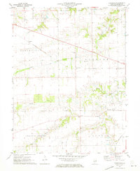
1971 Map of Farmingdale
USGS Topo · Published 1973About this map
Farmingdale and the surrounding agricultural townships of Gardner and Cartwright define this portion of Sangamon County in the early 1970s. The landscape is characterized by a dense network of drainage including Prairie Creek and Spring Creek, which are spanned by landmarks such as the Covered Bridge. The transportation infrastructure of the era is clearly marked by the prominent routes of the Baltimore and Ohio and Chicago and North Western railroads, which facilitated the movement of goods through small hubs like Richland.
Find a feature on this map
23 named features on this map. Tap any name to fly to it.
Don’t see what you’re looking for? This feature index may not catch every label — zoom into the map to look around manually.
Map Details
Editions of this 1971 Farmingdale Map
This is the sole edition of this map. No revisions or reprints were ever made.
Other maps of this area

1907 · Springfield
USGS Topo · 1:62,500

1909 · Tallula
USGS Topo · 1:62,500

1922 · Divernon
USGS Topo · 1:62,500

1924 · Divernon
USGS Topo · 1:62,500

1924 · Waverly
USGS Topo · 1:62,500

1926 · Waverly
USGS Topo · 1:62,500

1930 · Springfield
USGS Topo · 1:62,500

1940 · Tallula
USGS Topo · 1:62,500

1940 · Springfield
USGS Topo · 1:62,500

1950 · Springfield West
USGS Topo · 1:24,000