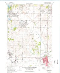
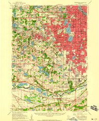
1974 Map of Farmington
USGS Topo · Published 1976About this map
Farmington and Apple Valley show significant suburban expansion in the mid-1970s, evidenced by the dense grid of residential developments like Parkview School and Scott Highlands Park. The landscape is a mix of new civic infrastructure and the area's agricultural past, with numerous Gravel Pits scattered between growing neighborhoods and older landmarks like St Josephs Cemetery. Transportation routes define the region's character, from the historic Dodd Road to the modern Airlake Industrial Airport. The presence of the Chicago Milwaukee St Paul and Pacific railroad running through the heart of Farmington near the County Fairground highlights the transition from a rail-dependent rural hub to a modern industrial and residential corridor. Local genealogy is well-represented by several burial grounds, including Lakeville Grove Cemetery and St Michaels Cemetery.
Find a feature on this map
68 named features on this map. Tap any name to fly to it.
Don’t see what you’re looking for? This feature index may not catch every label — zoom into the map to look around manually.
Map Details
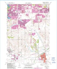
Editions of this 1974 Farmington Map
2 editions found
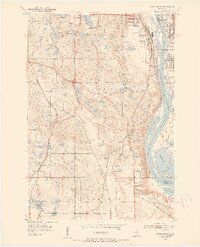
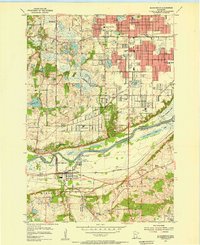
Other maps of this area

1896 · Minneapolis
USGS Topo · 1:62,500

1896 · St. Paul
USGS Topo · 1:62,500

1901 · Minneapolis
USGS Topo · 1:62,500
1951 · Inver Grove
USGS Topo · 1:24,000

1951 · St. Paul SW
USGS Topo · 1:24,000

1951 · St. Paul
USGS Topo · 1:62,500

1953 · Saint Paul
USGS Topo · 1:250,000
1954 · Bloomington
USGS Topo · 1:24,000
1954 · Minneapolis
USGS Topo · 1:62,500
1957 · Farmington
USGS Topo · 1:62,500