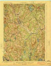
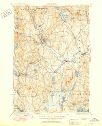
1924 Map of Farmington
USGS Topo · Published 1924About this map
The Sandy River winds through the heart of Franklin County, defining the early 20th-century development of Farmington and its surrounding agricultural valleys. This 1924 survey captures a landscape punctuated by numerous rural schoolhouses, such as Russell Mills School and Blanchard School, reflecting the decentralized education system of the era. The infrastructure of the Maine Central RR and the Rangeley Lakes and Maine Central RR provided vital links for settlements like Fairbanks and Dryden (Wilton Sta), facilitating the movement of timber and farm products.
Find a feature on this map
127 named features on this map. Tap any name to fly to it.
Don’t see what you’re looking for? This feature index may not catch every label — zoom into the map to look around manually.
Map Details
Editions of this 1924 Farmington Map
6 editions found
Other maps of this area

1892 · Augusta
USGS Topo · 1:62,500

1894 · Norridgewock
USGS Topo · 1:62,500

1898 · Norridgewock
USGS Topo · 1:62,500

1904 · Anson
USGS Topo · 1:62,500

1910 · Livermore
USGS Topo · 1:62,500

1911 · Buckfield
USGS Topo · 1:62,500

1912 · Livermore
USGS Topo · 1:62,500

1913 · Buckfield
USGS Topo · 1:62,500

1924 · Farmington
USGS Topo · 1:62,500

1926 · Dixfield
USGS Topo · 1:62,500