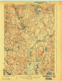
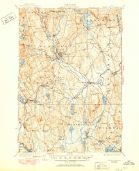
1924 Map of Farmington
USGS Topo · Published 1924About this map
The Sandy River winds through the heart of Franklin County, defining a valley of small agricultural settlements and timber-milling operations during the early 1920s. Centered on Farmington, the map reveals a landscape heavily dotted with one-room schoolhouses, including Norton Flat School, Goodrich School, and Bullen School, serving the outlying farmsteads. The rail economy is represented by the Maine Central line, which connects Wilton and the Dryden Wilton Sta to the commerce of West Farmington.
Find a feature on this map
106 named features on this map. Tap any name to fly to it.
Don’t see what you’re looking for? This feature index may not catch every label — zoom into the map to look around manually.
Map Details
Editions of this 1924 Farmington Map
6 editions found
Other maps of this area

1892 · Augusta
USGS Topo · 1:62,500

1894 · Norridgewock
USGS Topo · 1:62,500

1898 · Norridgewock
USGS Topo · 1:62,500

1904 · Anson
USGS Topo · 1:62,500

1910 · Livermore
USGS Topo · 1:62,500

1911 · Buckfield
USGS Topo · 1:62,500

1912 · Livermore
USGS Topo · 1:62,500

1913 · Buckfield
USGS Topo · 1:62,500

1924 · Farmington
USGS Topo · 1:62,500

1926 · Dixfield
USGS Topo · 1:62,500