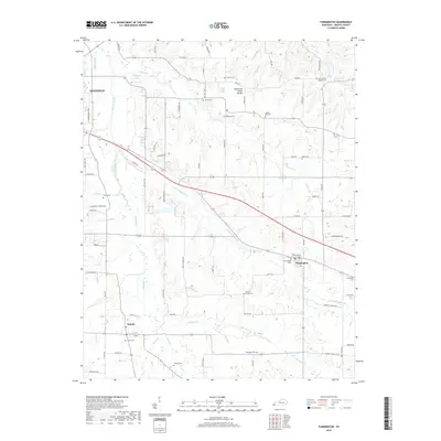
2019 Map of Farmington
USGS Topo · Published 2019About this map
Farmington and Sedalia serve as central hubs in this corner of Graves County, where the landscape is defined by the winding course of Mayfield Creek and its many tributaries. The area sits atop the Tennessee Valley Divide, a topographic feature that influences the drainage patterns of local waterways like Little Mayfield Cr and Vulton Cr. The map reveals a dense network of family and community history preserved in numerous burial grounds, including the Barton Family Cem, Smyrna Cem, and New Liberty Baptist Cem.
Find a feature on this map
83 named features on this map. Tap any name to fly to it.
Don’t see what you’re looking for? This feature index may not catch every label — zoom into the map to look around manually.
Map Details
Editions of this 2019 Farmington Map
This is the sole edition of this map. No revisions or reprints were ever made.
Other maps of this area

1936 · Farmington
USGS Topo · 1:24,000

1936 · Oak Level
USGS Topo · 1:24,000

1936 · Lynn Grove
USGS Topo · 1:24,000

1936 · Benton
USGS Topo · 1:48,000

1936 · Westplains
USGS Topo · 1:24,000

1936 · Kirksey
USGS Topo · 1:24,000

1951 · Kirksey
USGS Topo · 1:24,000

1951 · Farmington
USGS Topo · 1:24,000
1951 · Oak Level
USGS Topo · 1:24,000

1951 · Hickory
USGS Topo · 1:24,000