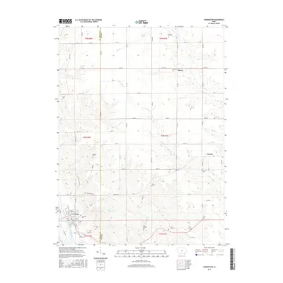
2015 Map of Farmington
USGS Topo · Published 2015About this map
The Des Moines River winds through the southwestern corner of this Iowa landscape, anchoring the settlement of Farmington. This 2015 data reflects a region deeply rooted in agricultural and conservation history, featuring the expansive Shimek Forest and its associated Shimek Forest Pond Two. The area is notably dense with small family and community burial grounds, which provide significant genealogical value for researchers tracing local lineages across the Van Buren and Lee County border.
Find a feature on this map
63 named features on this map. Tap any name to fly to it.
Don’t see what you’re looking for? This feature index may not catch every label — zoom into the map to look around manually.
Map Details
Editions of this 2015 Farmington Map
This is the sole edition of this map. No revisions or reprints were ever made.
Other maps of this area

1958 · Burlington
USGS Topo · 1:250,000

1961 · Burlington
USGS Topo · 1:250,000

1963 · Burlington
USGS Topo · 1:250,000

1968 · Anson
USGS Topo · 1:24,000

1968 · Bonaparte
USGS Topo · 1:24,000
1968 · Argyle
USGS Topo · 1:24,000

1968 · Donnellson
USGS Topo · 1:24,000
1968 · Croton
USGS Topo · 1:24,000

1968 · Farmington
USGS Topo · 1:24,000
1981 · Salem
USGS Topo · 1:24,000