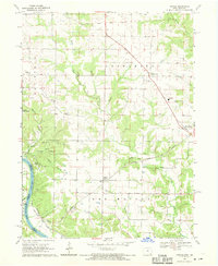
1968 Map of Argyle
USGS Topo · Published 1970About this map
Des Moines River frontage and the intricate network of the Atchison Topeka and Santa Fe railroad define this pocket of Lee County during the late 1960s. The landscape is a transition between the dense timber of Shimek State Forest and the fertile bottomlands of String Prairie. Small community hubs like Argyle and Charleston serve as anchors for the surrounding rural sections, while the map reveals the era's educational consolidation at Central High Sch.
Find a feature on this map
34 named features on this map. Tap any name to fly to it.
Don’t see what you’re looking for? This feature index may not catch every label — zoom into the map to look around manually.
Map Details
Editions of this 1968 Argyle Map
2 editions found
Other maps of this area

1903 · Kahoka
USGS Topo · 1:125,000

1936 · Keokuk
USGS Topo · 1:62,500

1936 · Fort Madison
USGS Topo · 1:62,500

1949 · Wayland
USGS Topo · 1:24,000

1949 · Kahoka
USGS Topo · 1:24,000

1950 · Kahoka
USGS Topo · 1:24,000

1950 · Wayland
USGS Topo · 1:24,000

1950 · Keokuk
USGS Topo · 1:62,500

1958 · Burlington
USGS Topo · 1:250,000

1961 · Burlington
USGS Topo · 1:250,000