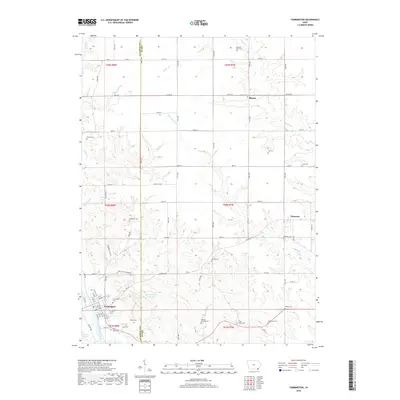
2018 Map of Farmington
USGS Topo · Published 2018About this map
The Des Moines River flows past the southwest corner of this landscape, anchoring the settlement of Farmington. This 2018 survey reveals a terrain defined by the border between Van Buren and Lee counties, where an intricate network of drainage systems like Sugar Creek, Lick Creek, and Slaughter Creek has carved the land into a complex series of ridges and valleys. Small unincorporated communities like Primrose and Sharon persist as local hubs, connected by a grid of rural roads and county routes such as County Road J40.
Find a feature on this map
56 named features on this map. Tap any name to fly to it.
Don’t see what you’re looking for? This feature index may not catch every label — zoom into the map to look around manually.
Map Details
Editions of this 2018 Farmington Map
This is the sole edition of this map. No revisions or reprints were ever made.
Other maps of this area

1958 · Burlington
USGS Topo · 1:250,000

1961 · Burlington
USGS Topo · 1:250,000

1963 · Burlington
USGS Topo · 1:250,000

1968 · Anson
USGS Topo · 1:24,000

1968 · Bonaparte
USGS Topo · 1:24,000
1968 · Argyle
USGS Topo · 1:24,000

1968 · Donnellson
USGS Topo · 1:24,000
1968 · Croton
USGS Topo · 1:24,000

1968 · Farmington
USGS Topo · 1:24,000
1981 · Salem
USGS Topo · 1:24,000