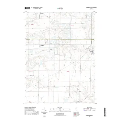
2018 Map of Farmington West
USGS Topo · Published 2018About this map
Farmington anchors the eastern edge of this western Illinois landscape, where the border of Knox and Fulton counties bisects a region defined by agricultural plots and winding creek beds. Small settlements like Middlegrove and Uniontown are scattered across the northern sections, while the southern reaches feature the hamlets of Gilchrist and Norris. This area is dense with family and community history, evidenced by numerous burial grounds such as Blakeslee Cem and Coal Creek Cem that dot the countryside. The terrain is deeply etched by the drainage networks of Littlers Cr and the S Fork Coal Cr, creating a complex topography of ridges and draws. Large-scale earthmoving is hinted at by the presence of Haulage Rd and the Midland Employees Lake, reflecting the intersection of local industry and the natural environment.
Find a feature on this map
70 named features on this map. Tap any name to fly to it.
Don’t see what you’re looking for? This feature index may not catch every label — zoom into the map to look around manually.
Map Details
Editions of this 2018 Farmington West Map
This is the sole edition of this map. No revisions or reprints were ever made.
Other maps of this area

1912 · Canton
USGS Topo · 1:62,500

1930 · Glasford
USGS Topo · 1:62,500

1941 · Maquon
USGS Topo · 1:62,500

1943 · Maquon
USGS Topo · 1:62,500

1944 · Elmwood
USGS Topo · 1:62,500

1948 · Elmwood
USGS Topo · 1:62,500

1948 · Glasford
USGS Topo · 1:62,500

1958 · Burlington
USGS Topo · 1:250,000

1958 · Peoria
USGS Topo · 1:250,000

1961 · Burlington
USGS Topo · 1:250,000