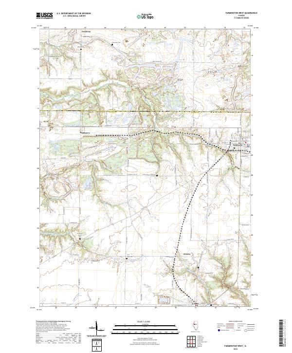
2024 Map of Farmington West
USGS Topo · Published 2024About this map
Farmington anchors the eastern edge of this landscape, where the prairie of central Illinois is deeply dissected by a network of drainage systems. The boundary between Knox Co and Fulton Co bisects the terrain, which is defined by the winding paths of North Branch Coal Creek and South Fork Coal Creek. Small settlements and rural clusters like Uniontown, Middlegrove, and Gilchrist are scattered throughout, connected by a grid of section-line roads and specialized routes like Haulage RD.
Find a feature on this map
76 named features on this map. Tap any name to fly to it.
Don’t see what you’re looking for? This feature index may not catch every label — zoom into the map to look around manually.
Map Details
Editions of this 2024 Farmington West Map
This is the sole edition of this map. No revisions or reprints were ever made.
Other maps of this area

1912 · Canton
USGS Topo · 1:62,500

1930 · Glasford
USGS Topo · 1:62,500

1941 · Maquon
USGS Topo · 1:62,500

1943 · Maquon
USGS Topo · 1:62,500

1944 · Elmwood
USGS Topo · 1:62,500

1948 · Elmwood
USGS Topo · 1:62,500

1948 · Glasford
USGS Topo · 1:62,500

1958 · Burlington
USGS Topo · 1:250,000

1958 · Peoria
USGS Topo · 1:250,000

1961 · Burlington
USGS Topo · 1:250,000