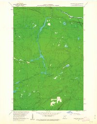
1960 Map of Farquhar Peak
USGS Topo · Published 1963About this map
The Grand Portage State Forest dominates this northern frontier, where the international boundary follows the winding course of the Pigeon River. In this 1960 survey, the landscape is defined by its complex hydrology, with the Swamp River and Irish Creek carving through the timberlands toward a series of isolated waters including Otter Lake, Moosehorn Lake, and Jackson Lake. The interior is largely roadless, focused instead on the natural topography and the southern boundary of the Grand Portage Indian Reservation. To the south, Farquhar Peak rises as a prominent landmark near the Hovland Lookout Tower, a site once essential for fire detection in the dense forest. Small-scale industrial activity is noted only by localized Gravel Pits, emphasizing the remote, resource-driven character of this Cook County region during the early 1960s.
Find a feature on this map
20 named features on this map. Tap any name to fly to it.
Don’t see what you’re looking for? This feature index may not catch every label — zoom into the map to look around manually.
Map Details
Editions of this 1960 Farquhar Peak Map
4 editions found
Other maps of this area

1954 · Two Harbors
USGS Topo · 1:250,000

1957 · Two Harbors
USGS Topo · 1:250,000

1957 · Quetico
USGS Topo · 1:250,000

1958 · Two Harbors
USGS Topo · 1:250,000

1958 · Hancock
USGS Topo · 1:250,000

1959 · Mineral Center
USGS Topo · 1:24,000

1959 · Pine Lake East
USGS Topo · 1:24,000

1959 · Tom Lake
USGS Topo · 1:24,000

1959 · Fort William
USGS Topo · 1:250,000

1960 · Hancock
USGS Topo · 1:250,000