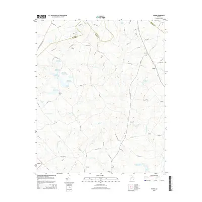
2014 Map of Farrar
USGS Topo · Published 2014About this map
Murder Creek and its complex network of tributaries define the topography of this Georgia landscape, which spans the junctions of Newton, Jasper, and Morgan counties. The 2014 survey reveals a region characterized by small rural settlements and a significant concentration of man-made water bodies. Near the community of Farrar, several large lakes including Quailwood Lake and Rex Haven Lakes highlight the transition toward managed water resources and residential land use. Genealogy researchers will find significant value in the documentation of several family and community burial sites, such as Shiloh Cem, Murder Creek Cem, and Loyd Cem. In the southern reaches, the settlement of Maxwell sits near the crossing at Barr Bridge, while the western terrain is marked by a series of numbered reservoirs including Boyle Lake Number One and the strikingly named Boyle Murder Lake.
Find a feature on this map
88 named features on this map. Tap any name to fly to it.
Don’t see what you’re looking for? This feature index may not catch every label — zoom into the map to look around manually.
Map Details
Editions of this 2014 Farrar Map
This is the sole edition of this map. No revisions or reprints were ever made.
Other maps of this area

1896 · Monroe
USGS Topo · 1:125,000

1953 · Athens
USGS Topo · 1:250,000

1958 · Athens
USGS Topo · 1:250,000

1959 · Athens
USGS Topo · 1:250,000

1963 · Athens
USGS Topo · 1:250,000

1964 · Lloyd Shoals Dam
USGS Topo · 1:24,000

1964 · Stewart
USGS Topo · 1:24,000

1964 · Covington
USGS Topo · 1:24,000

1972 · Monticello
USGS Topo · 1:24,000

1972 · Shady Dale
USGS Topo · 1:24,000