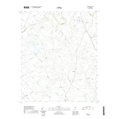
2020 Map of Farrar
USGS Topo · Published 2020About this map
Farrar and Maxwell serve as central points in this landscape where the boundaries of Jasper, Newton, and Morgan counties converge. The terrain is defined by a dense network of tributaries feeding into Murder Creek, which snakes southward through the center of the sheet. For genealogists and local historians, the map is particularly useful for locating family burial sites and rural congregations, including Shiloh Cem and Hopewell Baptist Cem. The area around Calvin and Palato reveals a pattern of dispersed rural living, with small lakes like Quailwood Lake and the Boyle Lake series providing local landmarks. The documentation of older road alignments, such as Pitts Chapel Rd and Post Rd, illustrates the enduring connectivity of these farming communities as they transitioned into the 21st century.
Find a feature on this map
95 named features on this map. Tap any name to fly to it.
Don’t see what you’re looking for? This feature index may not catch every label — zoom into the map to look around manually.
Map Details
Editions of this 2020 Farrar Map
This is the sole edition of this map. No revisions or reprints were ever made.
Other maps of this area

1896 · Monroe
USGS Topo · 1:125,000

1953 · Athens
USGS Topo · 1:250,000

1958 · Athens
USGS Topo · 1:250,000

1959 · Athens
USGS Topo · 1:250,000

1963 · Athens
USGS Topo · 1:250,000

1964 · Lloyd Shoals Dam
USGS Topo · 1:24,000

1964 · Stewart
USGS Topo · 1:24,000

1964 · Covington
USGS Topo · 1:24,000

1972 · Monticello
USGS Topo · 1:24,000

1972 · Shady Dale
USGS Topo · 1:24,000