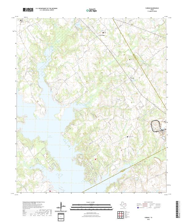
2022 Map of Farrar
USGS Topo · Published 2022About this map
Lake Limestone dominates the southwestern quadrant of this landscape, its irregular shoreline reaching deep into the drainage basins of Sanders Cr and Coots Br. This modern survey illustrates the rural interface where Limestone, Freestone, and Leon counties meet. Small communities like Farrar and Fair Oaks remain centered on a network of farm-to-market roads and local connectors such as FM 39 and LCR 836.
Find a feature on this map
95 named features on this map. Tap any name to fly to it.
Don’t see what you’re looking for? This feature index may not catch every label — zoom into the map to look around manually.
Map Details
Editions of this 2022 Farrar Map
This is the sole edition of this map. No revisions or reprints were ever made.
Other maps of this area

1919 · Fairfield
USGS Topo · 1:62,500

1920 · Mexia
USGS Topo · 1:62,500

1954 · Waco
USGS Topo · 1:250,000

1955 · Waco
USGS Topo · 1:250,000

1956 · Jewett
USGS Topo · 1:62,500

1965 · Jewett
USGS Topo · 1:24,000

1965 · Dew
USGS Topo · 1:24,000
1965 · Donie
USGS Topo · 1:24,000
1966 · Round Prairie
USGS Topo · 1:24,000
1966 · Teague South
USGS Topo · 1:24,000