
1962 Map of Farthing
USGS Topo · Published 1964About this map
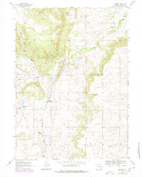
Farthing (Iron Mountain PO) serves as the central hub of this Laramie County landscape, where the Colorado and Southern railroad cuts a north-south path through the high plains. The area is defined by a network of established family operations, including the Farthing Ranch, Whiting Ranch, and Brownell Ranch, illustrating the importance of livestock and land ownership in this region during the early 1960s. Water management is critical in this environment, evidenced by the Farthing Reservoir and the winding courses of Chugwater Creek and Sand Creek. The terrain rises to landmarks like Pine Top, while the rail line connects smaller sidings or stops such as Lambert. This survey captures the rural infrastructure of the Wyoming ranching economy just as modern photogrammetric mapping was beginning to provide a more precise view of the drainage patterns and property boundaries that shaped local life.
Find a feature on this map
21 named features on this map. Tap any name to fly to it.
Don’t see what you’re looking for? This feature index may not catch every label — zoom into the map to look around manually.
Map Details
Editions of this 1962 Farthing Map
2 editions found
Other maps of this area

1905 · Sherman
USGS Topo · 1:125,000

1948 · Ragged Top Mountain
USGS Topo · 1:62,500

1950 · Ragged Top Mountain
USGS Topo · 1:62,500

1954 · Cheyenne
USGS Topo · 1:250,000

1955 · Indian Guide
USGS Topo · 1:24,000

1955 · Goat Mountain
USGS Topo · 1:24,000

1958 · Cheyenne
USGS Topo · 1:250,000

1962 · Horse Creek
USGS Topo · 1:24,000

1962 · Dereemer Ranch
USGS Topo · 1:24,000

1962 · Delano Ranch
USGS Topo · 1:24,000