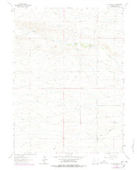
1962 Map of Farthing Ranch
USGS Topo · Published 1978About this map
Lodgepole Creek meanders through this high plains landscape in Laramie County, providing the lifeblood for isolated ranching operations during the early 1960s. The settlement of Farthing Ranch serves as a primary local landmark, situated north of the pipeline that traverses the terrain. This 1962 survey, which includes purple photorevisions from 1976, captures the sparse but functional infrastructure of the era, from a modest Gravel Pit to a working Corral. Of particular interest to surveyors and geographers is the Cheyenne East Base geodetic marker, while genealogists and local historians may find significance in the location of Wadill near the southern boundary. The map illustrates a transitional period in Wyoming's rural landscape, where traditional cattle ranching and modern utility corridors share the open range.
Find a feature on this map
8 named features on this map. Tap any name to fly to it.
Don’t see what you’re looking for? This feature index may not catch every label — zoom into the map to look around manually.
Map Details
Editions of this 1962 Farthing Ranch Map
2 editions found
Other maps of this area

1905 · Sherman
USGS Topo · 1:125,000

1911 · Cheyenne
USGS Topo · 1:125,000

1914 · Cheyenne
USGS Topo · 1:125,000

1950 · Cheyenne
USGS Topo · 1:62,500

1954 · Cheyenne
USGS Topo · 1:250,000

1958 · Cheyenne
USGS Topo · 1:250,000

1961 · Round Top Lake
USGS Topo · 1:24,000

1961 · Cheyenne
USGS Topo · 1:62,500

1961 · Cheyenne North
USGS Topo · 1:24,000

1962 · P O Ranch
USGS Topo · 1:24,000