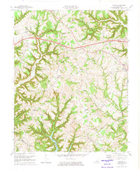
1973 Map of Faubush
USGS Topo · Published 1974About this map
Lake Cumberland dominates the southern landscape of this mid-century survey, its winding shoreline carving into the ridges of Pulaski Co and Russell Co. The terrain is defined by a series of prominent peaks and deep hollows, including Old Brown Knob, Harrison Knob, and Fish Trap Hollow. Small rural communities and crossroads like Faubush, Nancy, and Ingle are connected by a network of winding roads, including the modern Cumberland Parkway and an older Toll Road route. Local heritage is deeply etched into the land through numerous small family cemeteries and country churches, such as Tarter Cem, Weddle Cem, and Cooks Chapel. The map reveals a transition in transportation and land use, where rugged hollows like Greasy Hollow and Whittle Hollow meet the expanding reach of the reservoir and new highway infrastructure.
Find a feature on this map
75 named features on this map. Tap any name to fly to it.
Don’t see what you’re looking for? This feature index may not catch every label — zoom into the map to look around manually.
Map Details
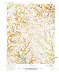
Editions of this 1973 Faubush Map
2 editions found
Other maps of this area

1911 · Monticello
USGS Topo · 1:62,500

1914 · Monticello
USGS Topo · 1:62,500

1932 · Burnside
USGS Topo · 1:62,500

1935 · Somerset
USGS Topo · 1:62,500

1953 · Phil
USGS Topo · 1:24,000

1953 · Frazer
USGS Topo · 1:24,000

1953 · Mintonville
USGS Topo · 1:24,000

1953 · Mill Springs
USGS Topo · 1:24,000

1954 · Jabez
USGS Topo · 1:24,000

1954 · Delmer
USGS Topo · 1:24,000