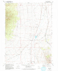
1993 Map of Faust
USGS Topo · Published 1993About this map
The Pony Express and Overland Stage Route cuts a historic path across the floor of Rush Valley, tracing a legacy of mid-19th-century mail delivery and transcontinental travel. This landscape is anchored by the Faust Pony Express Station Historical Marker near the settlement of Faust, highlighting the area's importance as a relief point for riders navigating the high desert. To the west, the Onaqui Mountains rise sharply, while the southern portion of the sheet reveals the Vernon Corporate Boundary near the Vernon Hills. The presence of a modern Landing Strip and an Aqueduct juxtaposes contemporary infrastructure with the older traces of the Lookout Pass Trail. Localized industry is represented by scattered Prospects and Borrow Pits, indicating the persistent mineral and material interest in this corner of Tooele County.
Find a feature on this map
18 named features on this map. Tap any name to fly to it.
Don’t see what you’re looking for? This feature index may not catch every label — zoom into the map to look around manually.
Map Details
Editions of this 1993 Faust Map
This is the sole edition of this map. No revisions or reprints were ever made.
Other maps of this area

1885 · Tooele Valley
USGS Topo · 1:250,000

1918 · Stockton
USGS Topo · 1:62,500

1953 · Tooele
USGS Topo · 1:250,000

1955 · Deseret Peak
USGS Topo · 1:62,500

1955 · Stockton
USGS Topo · 1:62,500

1955 · Tooele
USGS Topo · 1:250,000
1971 · Vernon NE
USGS Topo · 1:24,000
1971 · Faust
USGS Topo · 1:24,000

1971 · Onaqui Mts South
USGS Topo · 1:24,000
1971 · Vernon
USGS Topo · 1:24,000