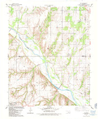
1985 Map of Fay
USGS Topo · Published 1985About this map
The Canadian River winds through this central Oklahoma landscape, cutting a wide path between the high ground of Boyd and the southern breaks of Deer Creek. In the mid-1980s, this area served as a crossroads for major transportation and energy infrastructure. Two prominent rail lines, the Atchison Topeka and Santa Fe and the Burlington Northern, traverse the terrain, reflecting the region's enduring role in freight and transit. The small settlements of Fay and Nobscot anchor the rural community, while the presence of numerous Gas Wells, a Compressor Station, and a large Pipeline indicate the heavy industrial footprint of the energy sector. Local history is preserved at sites like Mt Hope Cem and Liberty Cem, which sit among the section lines of Dewey, Custer, and Blaine counties.
Find a feature on this map
23 named features on this map. Tap any name to fly to it.
Don’t see what you’re looking for? This feature index may not catch every label — zoom into the map to look around manually.
Map Details
Editions of this 1985 Fay Map
This is the sole edition of this map. No revisions or reprints were ever made.
Other maps of this area

1955 · Clinton
USGS Topo · 1:250,000

1957 · Clinton
USGS Topo · 1:250,000

1957 · Clinton
USGS Topo · 1:62,500

1962 · Putnam
USGS Topo · 1:62,500

1964 · Oakwood
USGS Topo · 1:62,500

1964 · Weatherford
USGS Topo · 1:62,500

1976 · Clinton NE
USGS Topo · 1:24,000
1983 · Clinton NE
USGS Topo · 1:24,000
1985 · Eagle City
USGS Topo · 1:24,000
1985 · Watonga
USGS Topo · 1:100,000