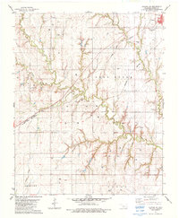
1983 Map of Clinton NE
USGS Topo · Published 1984About this map
Thomas and the northern reaches of A R A P A H O anchor this survey of Custer County, revealing a landscape defined by an extensive energy infrastructure and a legacy of rural communities. The area is marked by a dense concentration of Gas Wells and Gas Well sites, connected by a network of pipelines that cut across the undulating terrain. Transportation is dominated by the rail corridors of the Atchison Topeka and Santa Fe and Burlington Northern, which converge near the settlement of Foley. Local history is preserved in several small cemeteries, including Mound Valley Cem, Beck Cem, and Bethany Cem, which sit alongside the drainages of Deer Creek and Horse Creek. The presence of the small siding at Burgdorf and a Radio Tower further illustrate the mid-20th-century development of this agricultural and industrial region.
Find a feature on this map
22 named features on this map. Tap any name to fly to it.
Don’t see what you’re looking for? This feature index may not catch every label — zoom into the map to look around manually.
Map Details
Editions of this 1983 Clinton NE Map
This is the sole edition of this map. No revisions or reprints were ever made.
Other maps of this area

1955 · Clinton
USGS Topo · 1:250,000

1957 · Clinton
USGS Topo · 1:250,000

1957 · Clinton
USGS Topo · 1:62,500

1962 · Putnam
USGS Topo · 1:62,500

1964 · Oakwood
USGS Topo · 1:62,500

1964 · Weatherford
USGS Topo · 1:62,500

1976 · Clinton SE
USGS Topo · 1:24,000

1976 · Clinton SW
USGS Topo · 1:24,000

1976 · Clinton NW
USGS Topo · 1:24,000

1976 · Clinton NE
USGS Topo · 1:24,000