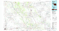
1985 Map of Watonga
USGS Topo · Published 1985About this map
The Canadian River and North Canadian River carve parallel southeastward paths across this mid-1980s landscape, framing the agricultural and educational hubs of central Oklahoma. The city of Clinton and the nearby Southwestern State College in Weatherford anchor the southern corridor, while the county seat of Watonga serves as a focal point to the north. This survey illustrates a region defined by its transit history, where the Atchison Topeka and Santa Fe and Chicago Rock Island and Pacific rail lines intersect with small farming communities like Thomas, Eagle City, and Loyal. Notable landmarks include the Roman Nose State Park and the Darlington State Game Bird Hatchery, alongside aviation sites like the Thomas P Stafford Airport. Local lore and geography meet at specifically named points such as Dead Women Crossing and Coyote Hill, providing a detailed look at the rural township and range system at the close of the 20th century.
Find a feature on this map
94 named features on this map. Tap any name to fly to it.
Don’t see what you’re looking for? This feature index may not catch every label — zoom into the map to look around manually.
Map Details
Editions of this 1985 Watonga Map
2 editions found
Other maps of this area

1892 · Kingfisher
USGS Topo · 1:125,000

1893 · Fort Reno
USGS Topo · 1:62,500

1893 · Buggy Creek
USGS Topo · 1:62,500

1893 · Hennessey
USGS Topo · 1:62,500

1893 · Minco
USGS Topo · 1:62,500

1893 · Loyal
USGS Topo · 1:62,500

1893 · Ames
USGS Topo · 1:62,500

1895 · Kingfisher
USGS Topo · 1:125,000

1904 · Chickasha
USGS Topo · 1:125,000

1941 · Fort Reno
USGS Topo · 1:62,500