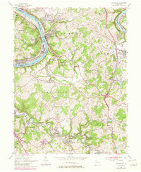
1954 Map of Fayette City
USGS Topo · Published 1979About this map
The Monongahela River carves a deep, winding path through this industrial corridor of Pennsylvania, as documented in 1954. Densely clustered riverfront towns like Fayette City and Belle Vernon show a landscape defined by steel-era transportation and coal, with the Pittsburgh and Lake Erie railroad tracing the water's edge. The industrial footprint is evident in landmarks like the Colonial Dock and numerous extraction sites, including the Brunerller Mine and various Strip Mines.
Find a feature on this map
72 named features on this map. Tap any name to fly to it.
Don’t see what you’re looking for? This feature index may not catch every label — zoom into the map to look around manually.
Map Details
Editions of this 1954 Fayette City Map
Other maps of this area

1900 · Uniontown
USGS Topo · 1:62,500

1900 · Masontown
USGS Topo · 1:62,500

1902 · Brownsville
USGS Topo · 1:62,500

1902 · Connellsville
USGS Topo · 1:62,500

1903 · Masontown
USGS Topo · 1:62,500

1906 · Brownsville
USGS Topo · 1:62,500

1931 · Brownsville
USGS Topo · 1:62,500

1931 · Connellsville
USGS Topo · 1:62,500

1931 · Uniontown
USGS Topo · 1:62,500

1931 · Masontown
USGS Topo · 1:62,500