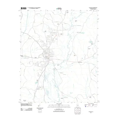
2011 Map of Fayette
USGS Topo · Published 2011About this map
Fayette and the surrounding Fayette County landscape are defined by the winding course of the Sipsey River and a significant subsurface energy economy. In this 2011 survey, the footprint of natural gas extraction is prominent, with the North Fayette Gas Field, Fayette Gas Field, and Musgrove Creek Gas Field marking the rural acreage surrounding the city center. The map documents the residential core of Old Town and smaller satellite communities like Rossland City and Gumbud. Local history and genealogy are well-represented by numerous burial sites, including the Fayette City Cemetery, Bankhead Cemetery, and Whitson Cemetery. The western edge of the quadrangle is shaped by Luxapallila Creek, while the southern reaches feature the topographic rise of Cains Ridge and the Cains Ridge Dam creating Cains Ridge Lake, illustrating the intersection of the region's natural hydrology and early 21st-century infrastructure.
Find a feature on this map
91 named features on this map. Tap any name to fly to it.
Don’t see what you’re looking for? This feature index may not catch every label — zoom into the map to look around manually.
Map Details
Editions of this 2011 Fayette Map
This is the sole edition of this map. No revisions or reprints were ever made.
Other maps of this area

1953 · Birmingham
USGS Topo · 1:250,000

1956 · Birmingham
USGS Topo · 1:250,000

1957 · Birmingham
USGS Topo · 1:250,000

1967 · Bankston
USGS Topo · 1:24,000

1967 · Winfield SE
USGS Topo · 1:24,000

1967 · Newtonville
USGS Topo · 1:24,000

1967 · Kennedy
USGS Topo · 1:24,000

1967 · Hubbertville
USGS Topo · 1:24,000

1967 · Bluff
USGS Topo · 1:24,000

1967 · Fayette
USGS Topo · 1:24,000