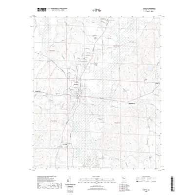
2020 Map of Fayette
USGS Topo · Published 2020About this map
The Fayette County Courthouse serves as the central anchor for the town of Fayette, a community defined by its proximity to the Sipsey River and Luxapallila Creek. This recent survey reveals a landscape where modern aviation at Richard Arthur Field coexists with deeply rooted local heritage preserved in numerous rural burial grounds. Settlements like Cedar Hill and Rossland City dot the surrounding terrain, which is segmented by family-named roads and regional routes. The map illustrates a transition from the urban grid of the county seat to the sprawling wetlands and lakes of the Sipsey basin, including Bagwell Lake and Harkins Lake. Genealogists will find significant value in the documentation of outlying cemeteries such as Edmonds - Musgrove Cem and Caines Ridge Cem, which serve as quiet markers of the area's ancestral homesteads and established rural congregations.
Find a feature on this map
108 named features on this map. Tap any name to fly to it.
Don’t see what you’re looking for? This feature index may not catch every label — zoom into the map to look around manually.
Map Details
Editions of this 2020 Fayette Map
This is the sole edition of this map. No revisions or reprints were ever made.
Other maps of this area

1953 · Birmingham
USGS Topo · 1:250,000

1956 · Birmingham
USGS Topo · 1:250,000

1957 · Birmingham
USGS Topo · 1:250,000

1967 · Bankston
USGS Topo · 1:24,000

1967 · Winfield SE
USGS Topo · 1:24,000

1967 · Newtonville
USGS Topo · 1:24,000

1967 · Kennedy
USGS Topo · 1:24,000

1967 · Hubbertville
USGS Topo · 1:24,000

1967 · Bluff
USGS Topo · 1:24,000

1967 · Fayette
USGS Topo · 1:24,000