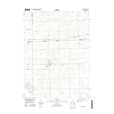
2013 Map of Fayette
USGS Topo · Published 2013About this map
The village of Fayette serves as the central hub of this borderland landscape, situated just south of the Michigan-Ohio state line. The map highlights a complex hydrographic network where Spring Cr and Stag Run converge near the town center, eventually feeding into the larger drainage of Bean Creek and its historical channel, Old Bean Cr. To the north, the small settlement of Munson sits near the crossing of Iron Creek and the state boundary, reflecting the shared geography between Lenawee County and Fulton County.
Find a feature on this map
52 named features on this map. Tap any name to fly to it.
Don’t see what you’re looking for? This feature index may not catch every label — zoom into the map to look around manually.
Map Details
Editions of this 2013 Fayette Map
This is the sole edition of this map. No revisions or reprints were ever made.
Other maps of this area

1911 · Wauseon
USGS Topo · 1:62,500

1913 · Wauseon
USGS Topo · 1:62,500

1913 · Alvordton
USGS Topo · 1:62,500

1943 · Wauseon
USGS Topo · 1:62,500

1944 · Alvordton
USGS Topo · 1:62,500

1953 · Fort Wayne
USGS Topo · 1:250,000

1956 · Fort Wayne
USGS Topo · 1:250,000

1959 · Archbold
USGS Topo · 1:24,000
1960 · Wauseon
USGS Topo · 1:24,000

1960 · Morenci
USGS Topo · 1:24,000