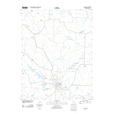
2012 Map of Fayette
USGS Topo · Published 2012About this map
Fayette serves as the central hub of this Missouri landscape, where the town grid is defined by streets like Reynolds St and Givens Rd. The surrounding terrain is heavily carved by a network of waterways including Bonne Femme Creek, Adams Fork, and Leach Creek, which feed into numerous man-made water bodies such as Rogers Lake, Elliot Davis Lake, and the curiously named Taylors Folly Reservoir.
Find a feature on this map
92 named features on this map. Tap any name to fly to it.
Don’t see what you’re looking for? This feature index may not catch every label — zoom into the map to look around manually.
Map Details
Editions of this 2012 Fayette Map
This is the sole edition of this map. No revisions or reprints were ever made.
Other maps of this area

1890 · Glasgow
USGS Topo · 1:125,000

1947 · Glasgow
USGS Topo · 1:62,500

1952 · New Franklin
USGS Topo · 1:24,000

1952 · Hilldale
USGS Topo · 1:24,000

1953 · Moberly
USGS Topo · 1:250,000

1953 · Fayette
USGS Topo · 1:24,000

1953 · Burton
USGS Topo · 1:24,000

1953 · Higbee
USGS Topo · 1:24,000

1953 · Armstrong
USGS Topo · 1:24,000

1954 · Moberly
USGS Topo · 1:250,000