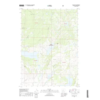
2017 Map of Fayette Lake
USGS Topo · Published 2017About this map
Bridger National Forest land defines this corner of Sublette County, where high-country waters flow through a complex system of glacially carved basins. Large water bodies such as Half Moon Lake, Fayette Lake, and Burnt Lake dominate the lower elevations, while higher reaches are dotted with smaller alpine features like Junction Lake and Black Lake. The topography is marked by significant landmarks including Half Moon Mtn and Fortification Mtn, separated by deep drainages like Sweeney Creek and Meadow Cr.
Find a feature on this map
37 named features on this map. Tap any name to fly to it.
Don’t see what you’re looking for? This feature index may not catch every label — zoom into the map to look around manually.
Map Details
Editions of this 2017 Fayette Lake Map
This is the sole edition of this map. No revisions or reprints were ever made.
Other maps of this area

1909 · Fremont Peak
USGS Topo · 1:125,000

1955 · Thermopolis
USGS Topo · 1:250,000

1955 · Lander
USGS Topo · 1:250,000

1958 · Lander
USGS Topo · 1:250,000

1958 · Thermopolis
USGS Topo · 1:250,000

1961 · Lander
USGS Topo · 1:250,000

1962 · Thermopolis
USGS Topo · 1:250,000

1964 · Boulder Lake
USGS Topo · 1:24,000
1964 · Pinedale
USGS Topo · 1:24,000

1964 · Fremont Lake South
USGS Topo · 1:24,000