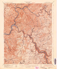
1931 Map of Fayetteville
USGS Topo · Published 1931About this map
Gauley River and New River converge at Gauley Bridge, carving through the steep topography of Gauley Mountain. This 1931 edition reflects a landscape defined by its heavy industrial transit, with the Chesapeake and Ohio Railroad and the Virginian Railroad following the narrow river benches. Local commerce is clustered in coal and transit hubs like Nuttallburg, Glen Ferris, and South Caperton. Civil engineering of the era is evidenced by the Blue Hole Tunnel and the crossing of the Midland Highway through the canyon. Away from the water, the plateau above Fayetteville supports a network of rural life, including family-named schools like Dickerson Sch and Duncan Sch, alongside small congregations at Mt Olive Ch and Mt Zion Ch.
Find a feature on this map
111 named features on this map. Tap any name to fly to it.
Don’t see what you’re looking for? This feature index may not catch every label — zoom into the map to look around manually.
Map Details
Editions of this 1931 Fayetteville Map
3 editions found
Other maps of this area

1887 · Hinton
USGS Topo · 1:125,000

1889 · Nicholas
USGS Topo · 1:125,000

1891 · Nicholas
USGS Topo · 1:125,000

1891 · Raleigh
USGS Topo · 1:125,000

1892 · Hinton
USGS Topo · 1:125,000

1897 · Kanawha Falls
USGS Topo · 1:125,000

1897 · Raleigh
USGS Topo · 1:125,000

1900 · Kanawha Falls
USGS Topo · 1:125,000

1901 · Nicholas
USGS Topo · 1:125,000

1901 · Kanawha Falls
USGS Topo · 1:125,000