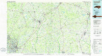
1986 Map of Fayetteville
USGS Topo · Published 1986About this map
Fayetteville and its surrounding coastal plain communities are depicted here during the mid-1980s, a period of established military presence and regional connectivity. The landscape is dominated by the sprawling Fort Bragg Military Reservation and Pope Air Force Base to the west, while the eastern reaches extend toward Goldsboro and the Neuse River. The Cape Fear River serves as a primary geographical spine, winding past Lillington and the cliffs of Raven Rock State Park.
Find a feature on this map
168 named features on this map. Tap any name to fly to it.
Don’t see what you’re looking for? This feature index may not catch every label — zoom into the map to look around manually.
Map Details
Editions of this 1986 Fayetteville Map
2 editions found
Other maps of this area

1902 · Kenly
USGS Topo · 1:62,500

1903 · Kenly
USGS Topo · 1:62,500

1904 · Wilson
USGS Topo · 1:62,500

1906 · Four Oaks
USGS Topo · 1:48,000

1908 · Four Oaks
USGS Topo · 1:62,500

1909 · Coharie
USGS Topo · 1:62,500

1943 · Kenansville
USGS Topo · 1:62,500

1948 · Kenansville
USGS Topo · 1:62,500

1948 · Fayetteville
USGS Topo · 1:62,500

1948 · Clifdale
USGS Topo · 1:62,500