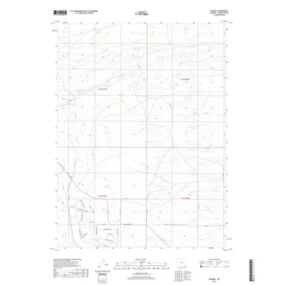
2017 Map of Federal
USGS Topo · Published 2017About this map
The settlement of Federal serves as a small anchor for this Laramie County landscape, defined by a network of rural roads and grazing lands. Water management is a primary feature of the high plains terrain, as seen in the system involving Chadwick Ditch Number 5 and the two impoundments of Chadwick Reservoir Number 1 and Chadwick Reservoir Number 2. These features, along with Lodgepole Cr and S Lodgepole Cr, indicate a long-standing reliance on irrigation and water storage for the local ranching economy.
Find a feature on this map
36 named features on this map. Tap any name to fly to it.
Don’t see what you’re looking for? This feature index may not catch every label — zoom into the map to look around manually.
Map Details
Editions of this 2017 Federal Map
This is the sole edition of this map. No revisions or reprints were ever made.
Other maps of this area

1905 · Sherman
USGS Topo · 1:125,000

1911 · Cheyenne
USGS Topo · 1:125,000

1914 · Cheyenne
USGS Topo · 1:125,000

1950 · Cheyenne
USGS Topo · 1:62,500

1954 · Cheyenne
USGS Topo · 1:250,000

1958 · Cheyenne
USGS Topo · 1:250,000

1961 · Round Top Lake
USGS Topo · 1:24,000

1961 · Cheyenne
USGS Topo · 1:62,500

1962 · Horse Creek
USGS Topo · 1:24,000

1962 · Federal
USGS Topo · 1:24,000