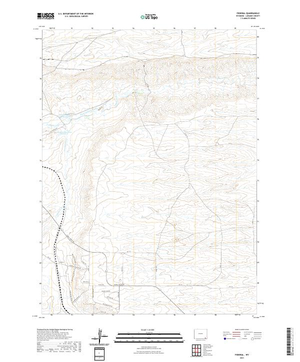
2021 Map of Federal
USGS Topo · Published 2021About this map
Federal serves as the primary settlement hub in this high-plains landscape, situated along the southern edge of the quadrangle. The area is defined by a series of drainages and man-made water management features, including the meandering Lodgepole Cr and its southern tributary, S Lodgepole Cr. The presence of the Chadwick Ditch Number 5 feeding into Chadwick Reservoir Number 1 and Chadwick Reservoir Number 2 illustrates the critical role of water diversion for sustaining life and agriculture in this semi-arid Laramie County region.
Find a feature on this map
37 named features on this map. Tap any name to fly to it.
Don’t see what you’re looking for? This feature index may not catch every label — zoom into the map to look around manually.
Map Details
Editions of this 2021 Federal Map
This is the sole edition of this map. No revisions or reprints were ever made.
Other maps of this area

1905 · Sherman
USGS Topo · 1:125,000

1911 · Cheyenne
USGS Topo · 1:125,000

1914 · Cheyenne
USGS Topo · 1:125,000

1950 · Cheyenne
USGS Topo · 1:62,500

1954 · Cheyenne
USGS Topo · 1:250,000

1958 · Cheyenne
USGS Topo · 1:250,000

1961 · Round Top Lake
USGS Topo · 1:24,000

1961 · Cheyenne
USGS Topo · 1:62,500

1962 · Horse Creek
USGS Topo · 1:24,000

1962 · Federal
USGS Topo · 1:24,000