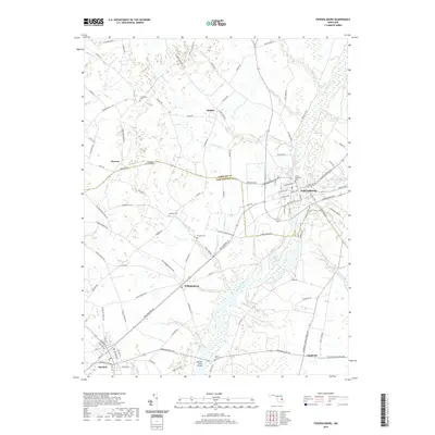
2019 Map of Federalsburg
USGS Topo · Published 2019About this map
Marshyhope Creek defines the local geography of the Eastern Shore, winding south through the center of Federalsburg and past the rural hamlets of Williamsburg and Finchville. This landscape reflects a mix of small-town development and long-standing agricultural boundaries, as evidenced by the winding path of Harrison Ferry Rd crossing the water at the Harrison Ferry Bridge. The area is dotted with family and church-affiliated landmarks, including Union Methodist Cem and the more isolated Skinners Cem and Solomon Cem, which offer significant value for genealogical research.
Find a feature on this map
107 named features on this map. Tap any name to fly to it.
Don’t see what you’re looking for? This feature index may not catch every label — zoom into the map to look around manually.
Map Details
Editions of this 2019 Federalsburg Map
This is the sole edition of this map. No revisions or reprints were ever made.
Other maps of this area

1905 · Denton
USGS Topo · 1:62,500

1905 · Hurlock
USGS Topo · 1:62,500

1915 · Seaford
USGS Topo · 1:62,500

1918 · Harrington
USGS Topo · 1:62,500
1944 · Preston
USGS Topo · 1:31,680

1944 · Federalsburg
USGS Topo · 1:31,680
1944 · East New Market
USGS Topo · 1:31,680

1944 · Seaford
USGS Topo · 1:62,500

1944 · Hobbs
USGS Topo · 1:31,680
1944 · Fowling Creek
USGS Topo · 1:31,680