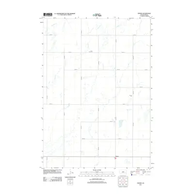
2012 Map of Fedora
USGS Topo · Published 2012About this map
Fedora anchors this portion of Sanborn County, centered around a modest grid of gravel roads and the local Po. The surrounding landscape is defined by the winding paths of Jim Cr and Redstone Cr, which drain the agricultural plains. Notable for family history researchers are the two distinct burial sites preserved in the township: Prairie Flower Cem to the north and Morgans Cem further east. The map illustrates a highly organized section-line road system, including 226th St through 232nd St, which facilitates movement between the scattered farmsteads and the central settlement of Fedora. Drainage patterns from W Redstone Cr further characterize this quiet stretch of the South Dakota prairie.
Find a feature on this map
20 named features on this map. Tap any name to fly to it.
Don’t see what you’re looking for? This feature index may not catch every label — zoom into the map to look around manually.
Map Details
Editions of this 2012 Fedora Map
This is the sole edition of this map. No revisions or reprints were ever made.
Other maps of this area

1899 · Alexandria
USGS Topo · 1:125,000

1899 · De Smet
USGS Topo · 1:125,000

1953 · Watertown
USGS Topo · 1:250,000

1955 · Sioux Falls
USGS Topo · 1:250,000

1957 · Farwell NW
USGS Topo · 1:24,000

1958 · Sioux Falls
USGS Topo · 1:250,000

1958 · Watertown
USGS Topo · 1:250,000
1971 · Artesian NW
USGS Topo · 1:24,000

1971 · Fedora
USGS Topo · 1:24,000
1971 · Artesian
USGS Topo · 1:24,000