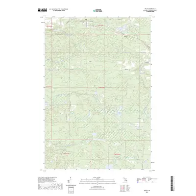
2023 Map of Felch
USGS Topo · Published 2023About this map
The settlement of Felch serves as the focal point for this Dickinson County terrain, situated near the Felch Cem and the winding course of Quarry Creek. The landscape is defined by the convergence of several significant water systems, most notably the West Branch Sturgeon River and the East Branch Sturgeon River, which carve through the dense forests of northern Michigan. Local history is reflected in the naming of rural roads such as Metropolitan Rd and Nurse Carlson Rd, while the Felch Grade Route Trl hints at the area's industrial past and former rail corridors.
Find a feature on this map
49 named features on this map. Tap any name to fly to it.
Don’t see what you’re looking for? This feature index may not catch every label — zoom into the map to look around manually.
Map Details
Editions of this 2023 Felch Map
This is the sole edition of this map. No revisions or reprints were ever made.
Other maps of this area

1954 · Escanaba
USGS Topo · 1:250,000

1955 · Norway
USGS Topo · 1:24,000

1955 · Vulcan
USGS Topo · 1:24,000

1955 · Norway
USGS Topo · 1:62,500

1955 · Ralph
USGS Topo · 1:62,500

1956 · Foster City
USGS Topo · 1:62,500

1957 · Escanaba
USGS Topo · 1:250,000

1957 · Northland
USGS Topo · 1:62,500

1958 · Escanaba
USGS Topo · 1:250,000

1958 · Marquette
USGS Topo · 1:250,000