
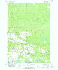
1955 Map of Vulcan
USGS Topo · Published 1957About this map
Iron ore mining and the timber industry define this mid-century landscape in the Upper Peninsula. Centered on the communities of Vulcan and Loretto, the map documents the extractive infrastructure of the Menominee Range, including the Loretta Mine and Appleton Mine. The heavy industrial footprint of the Chicago and North Western Railroad is visible alongside extensive mine dumps near Hanbury Lake.
Find a feature on this map
29 named features on this map. Tap any name to fly to it.
Don’t see what you’re looking for? This feature index may not catch every label — zoom into the map to look around manually.
Map Details
Editions of this 1955 Vulcan Map
2 editions found
Other maps of this area

1939 · Pembine
USGS Topo · 1:48,000

1947 · Pembine
USGS Topo · 1:48,000

1954 · Escanaba
USGS Topo · 1:250,000

1955 · Norway
USGS Topo · 1:24,000

1955 · Norway
USGS Topo · 1:62,500

1956 · Foster City
USGS Topo · 1:62,500

1957 · Escanaba
USGS Topo · 1:250,000

1958 · Escanaba
USGS Topo · 1:250,000

1963 · Pembine
USGS Topo · 1:62,500

1963 · Powers
USGS Topo · 1:62,500