
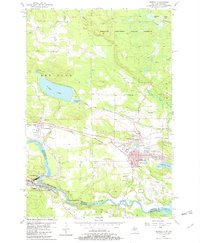
1955 Map of Norway
USGS Topo · Published 1957About this map
Mining operations and iron-ore history dominate the landscape between Quinnesec and Norway, Michigan. By the mid-1950s, the Menominee Range was marked by numerous quiet sites such as the Indiana Mine, Aragon Mine, and West Vulcan Mine, reflecting an industrial transition in Dickinson County. The Chicago and North Western railroad cuts across the terrain, alongside remnants of an Old Chicago Railroad Grade, connecting these settlements to the river-driven industry of the south. Along the Menominee River, which forms the border with Wisconsin, significant water features like Little Quinnesec Falls and Sand Portage Falls provided power for the region, while the Kimberly Clark Lookout Tower stood watch over the surrounding timberlands of the Sturgeon River State Forest. Local community life is evidenced by the McKinley and Norway schools and the presence of the City Hall and Hospital.
Find a feature on this map
41 named features on this map. Tap any name to fly to it.
Don’t see what you’re looking for? This feature index may not catch every label — zoom into the map to look around manually.
Map Details
Editions of this 1955 Norway Map
3 editions found
Other maps of this area

1939 · Pembine
USGS Topo · 1:48,000

1939 · Dunbar
USGS Topo · 1:48,000

1939 · Iron Mountain
USGS Topo · 1:48,000

1941 · Dunbar
USGS Topo · 1:48,000

1941 · Iron Mountain
USGS Topo · 1:48,000

1947 · Pembine
USGS Topo · 1:48,000

1947 · Dunbar
USGS Topo · 1:48,000

1947 · Iron Mountain
USGS Topo · 1:48,000

1954 · Iron Mountain
USGS Topo · 1:250,000

1954 · Escanaba
USGS Topo · 1:250,000