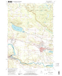
1955 Map of Norway
USGS Topo · Published 1982About this map
Iron mining history dominates this mid-century landscape of the Menominee Range, where the industrial legacy of Norway and Quinnesec is etched into the terrain. Numerous dormant operations including the Aragon Mine, Norway Mine, and Quinnesec Mine surround the town centers, reflecting an era when underground riches drove the local economy. The transportation network is defined by the Chicago and North Western railroad and various stretches of Old Railroad Grade, which once funneled ore toward the shipping ports.
Find a feature on this map
55 named features on this map. Tap any name to fly to it.
Don’t see what you’re looking for? This feature index may not catch every label — zoom into the map to look around manually.
Map Details
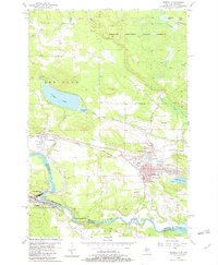
Editions of this 1955 Norway Map
3 editions found

Other maps of this area

1939 · Pembine
USGS Topo · 1:48,000

1939 · Dunbar
USGS Topo · 1:48,000

1939 · Iron Mountain
USGS Topo · 1:48,000

1941 · Dunbar
USGS Topo · 1:48,000

1941 · Iron Mountain
USGS Topo · 1:48,000

1947 · Pembine
USGS Topo · 1:48,000

1947 · Dunbar
USGS Topo · 1:48,000

1947 · Iron Mountain
USGS Topo · 1:48,000

1954 · Iron Mountain
USGS Topo · 1:250,000

1954 · Escanaba
USGS Topo · 1:250,000