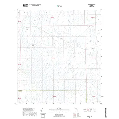
2018 Map of Felda SE
USGS Topo · Published 2018About this map
The low-lying wetlands of the Florida Everglades dominate this landscape along the border of Collier and Hendry Counties. This environment is defined by expansive marshlands punctuated by slightly elevated terrain, including Dog Island, Grasshopper Island, and Butterfly Island. These named islands and hammocks represent critical high ground in an area otherwise dictated by the movement of water through features like Lime Slough and Hooper Slough. Man-made infrastructure is limited to a few arterial routes such as Co Rd 832 and the circling Loop Rd, which skirt the edges of the primary wetlands. Further south, Roney Island and Wild Cow Island stand out as distinct landmarks in the interior. This map is a record of the complex hydrography of the region before further modern drainage or development, showing the natural drainage patterns of the sloughs and the isolated nature of the named hammocks.
Find a feature on this map
21 named features on this map. Tap any name to fly to it.
Don’t see what you’re looking for? This feature index may not catch every label — zoom into the map to look around manually.
Map Details
Editions of this 2018 Felda SE Map
This is the sole edition of this map. No revisions or reprints were ever made.
Other maps of this area

1956 · West Palm Beach
USGS Topo · 1:250,000

1957 · West Palm Beach
USGS Topo · 1:250,000

1958 · West Palm Beach
USGS Topo · 1:250,000

1958 · Felda SE
USGS Topo · 1:24,000

1958 · Immokalee
USGS Topo · 1:24,000

1958 · Felda
USGS Topo · 1:24,000

1958 · Immokalee NE
USGS Topo · 1:24,000

1958 · Felda NE
USGS Topo · 1:24,000

1958 · Sears
USGS Topo · 1:24,000

1970 · La Belle 4 NW
USGS Topo · 1:24,000