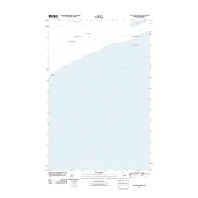
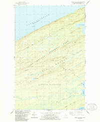
2011 Map of Feldtmann Ridge
USGS Topo · Published 2011About this map
Feldtmann Ridge dominates the northern shoreline of Isle Royale in this early 21st-century survey, rising above the cold waters of Lake Superior. The landscape is defined by its isolation and topographical elevation, capped by the Feldtmann Lookout Tower, a critical landmark for monitoring the surrounding wilderness. To the north, the Big Siskiwit River flows toward the coast, while Lake Halloran sits nestled between the high ground of Coyote Ridge and the rocky shoreline. The map reveals the intricate coastal geography of the island, from the submerged hazards of McCormick Reef to the exposed Long Point. This record captures the park's primitive character and the essential navigation and fire-safety infrastructure established to manage its remote interior.
Find a feature on this map
9 named features on this map. Tap any name to fly to it.
Don’t see what you’re looking for? This feature index may not catch every label — zoom into the map to look around manually.
Map Details
Editions of this 2011 Feldtmann Ridge Map
This is the sole edition of this map. No revisions or reprints were ever made.
Other maps of this area

1958 · Hancock
USGS Topo · 1:250,000

1960 · Hancock
USGS Topo · 1:250,000

1961 · Hancock
USGS Topo · 1:250,000

1966 · Hancock
USGS Topo · 1:250,000

1985 · Siskiwit Bay
USGS Topo · 1:100,000

1985 · Grand Portage
USGS Topo · 1:100,000
1985 · Feldtmann Ridge
USGS Topo · 1:24,000
1985 · Feldtmann Lake
USGS Topo · 1:24,000
1985 · Windigo
USGS Topo · 1:24,000
1985 · Sugar Mountain
USGS Topo · 1:24,000