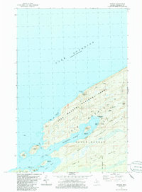
1985 Map of Windigo
USGS Topo · Published 1986About this map
Isle Royale is depicted here at the southwest end of the island, anchored by the settlement of Windigo and the expansive Washington Harbor. This wilderness landscape, managed as Isle Royale National Park, is defined by a series of parallel geologic features including Minong Ridge and Greenstone Ridge. The mapping shows the transition of the island from its extractive industrial past, represented by the Wendigo Mines, to a protected natural area with established backcountry routes like the Feldtmann Lake Trail. Dozens of smaller islands, such as Johns Island and Thompson Island, dot the coast where ferry routes connect the harbor to the mainland. Coastal landmarks including a Ranger Station, Gaging Station, and various campgrounds reflect the mid-1980s infrastructure supporting both maritime navigation and park recreation.
Find a feature on this map
40 named features on this map. Tap any name to fly to it.
Don’t see what you’re looking for? This feature index may not catch every label — zoom into the map to look around manually.
Map Details
Editions of this 1985 Windigo Map
2 editions found
Other maps of this area

1958 · Hancock
USGS Topo · 1:250,000

1959 · Fort William
USGS Topo · 1:250,000

1960 · Hancock
USGS Topo · 1:250,000

1961 · Hancock
USGS Topo · 1:250,000

1966 · Hancock
USGS Topo · 1:250,000

1968 · Fort William
USGS Topo · 1:250,000

1985 · Pigeon Point
USGS Topo · 1:100,000

1985 · Grand Portage
USGS Topo · 1:100,000
1985 · Feldtmann Ridge
USGS Topo · 1:24,000
1985 · Feldtmann Lake
USGS Topo · 1:24,000