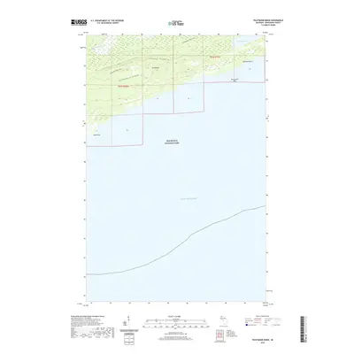
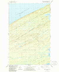
2019 Map of Feldtmann Ridge
USGS Topo · Published 2019About this map
Isle Royale National Park dominates the landscape of this Lake Superior wilderness, where tectonic forces and glaciation have left a series of parallel upland features. The prominent Feldtmann Ridge and adjacent Coyote Ridge run southwest-to-northeast, defining the island's interior topography and providing the route for the Feldtmann Ridge Trail. These basaltic ridges overlook the lower drainages where the Big Siskiwit River flows toward the coast. Along the shoreline, the map identifies specific maritime and coastal landmarks such as Long Point, Attwood Beach, and the offshore McCormick Reef. Further inland, Lake Halloran sits tucked behind the coastal heights, illustrating the diverse interior hydrology of the island. This survey provides a clear view of the wilderness trail systems and geological formations that characterize the southwestern portion of the archipelago in the early 21st century.
Find a feature on this map
13 named features on this map. Tap any name to fly to it.
Don’t see what you’re looking for? This feature index may not catch every label — zoom into the map to look around manually.
Map Details
Editions of this 2019 Feldtmann Ridge Map
This is the sole edition of this map. No revisions or reprints were ever made.
Other maps of this area

1958 · Hancock
USGS Topo · 1:250,000

1960 · Hancock
USGS Topo · 1:250,000

1961 · Hancock
USGS Topo · 1:250,000

1966 · Hancock
USGS Topo · 1:250,000

1985 · Siskiwit Bay
USGS Topo · 1:100,000

1985 · Grand Portage
USGS Topo · 1:100,000
1985 · Feldtmann Ridge
USGS Topo · 1:24,000
1985 · Feldtmann Lake
USGS Topo · 1:24,000
1985 · Windigo
USGS Topo · 1:24,000
1985 · Sugar Mountain
USGS Topo · 1:24,000