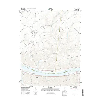
2013 Map of Felicity
USGS Topo · Published 2013About this map
The Ohio River valley serves as the primary corridor of this 2013 survey, dividing the village of Augusta and the community of Wellsburg in Kentucky from the townships of southern Ohio. The northern portion of the map is dominated by the village of Felicity, a hub for surrounding agricultural operations such as the Seibert Swine Farms. The landscape is etched by a dense network of tributaries including Bullskin Creek and Bear Cr, which carve deep valleys between high ground like Shinkles Ridge. This topography influenced the placement of numerous family and community burial sites, including the Hard Scrabble Cem and Smyrna Cem. Small settlements like Utopia, Cedron, and Rural occupy the transitional lands between the river bluffs and the uplands, while the Utter Field Airport provides a localized aviation link near Felicity.
Find a feature on this map
136 named features on this map. Tap any name to fly to it.
Don’t see what you’re looking for? This feature index may not catch every label — zoom into the map to look around manually.
Map Details
Editions of this 2013 Felicity Map
This is the sole edition of this map. No revisions or reprints were ever made.
Other maps of this area

1915 · Maysville
USGS Topo · 1:62,500

1919 · Maysville
USGS Topo · 1:62,500

1928 · Higginsport
USGS Topo · 1:48,000

1931 · Felicity
USGS Topo · 1:62,500

1931 · Higginsport
USGS Topo · 1:62,500

1952 · Germantown
USGS Topo · 1:24,000

1952 · Higginsport
USGS Topo · 1:24,000

1952 · Berlin
USGS Topo · 1:24,000

1952 · Brooksville
USGS Topo · 1:24,000

1953 · Laurel
USGS Topo · 1:24,000